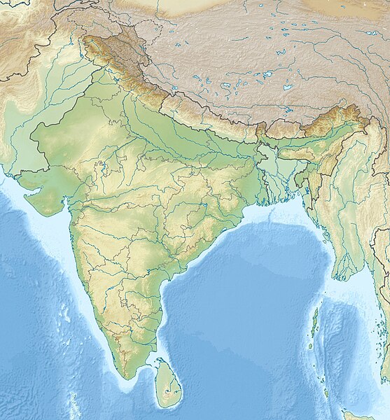
ဝှာင်:India relief location map.jpg

ဇမၞော် နမူနာ ဏအ် - ၅၅၇ × ၆၀၀ pixels အရာမသ္ဂုတ်သွာတ်လဝ်ဂမၠိုၚ်: ၂၂၃ × ၂၄၀ pixels | ၄၄၆ × ၄၈၀ pixels | ၇၁၃ × ၇၆၈ pixels | ၉၅၁ × ၁၀၂၄ pixels | ၁၅၀၀ × ၁၆၁၅ pixels တၞဟ်။
ဝှာင် တမ်မူလ (၁၅၀၀ × ၁၆၁၅ pixels, file size: ၁.၉၁ MB, MIME type: image/jpeg)
ဝှာင် လၟေင်အပြံင်အလှာဲ
ဍဵု လတူ စၟတ်တ္ၚဲ/အခိင် မွဲမွဲ သွက်ဂွံ ထ္ၜးကဵု ဝှာင် မကတဵုဒှ်လဝ် ပ္ဍဲအခိင်ဂှ်၊၊
| စၟတ်တ္ၚဲ/အခိင် | ဗီုပြင်နမူနာ | ပမာဏ | ညးလွပ် | တင်ပသောင်ကလး | |
|---|---|---|---|---|---|
| လၟုဟ် | ၂၀:၂၆၊ ၁၄ အံက်တဝ်ဗါ ၂၀၂၀ |  | ၁၅၀၀ × ၁၆၁၅ (၁.၉၁ MB) | NordNordWest | upd Telangana/Andhra Pradesh |
| ၂၂:၁၈၊ ၁၇ ဂျူလာင် ၂၀၂၀ |  | ၁၅၀၀ × ၁၆၁၅ (၁.၉၁ MB) | NordNordWest | + Ladakh | |
| ၂၂:၂၁၊ ၃၁ ဂျူလာင် ၂၀၁၆ |  | ၁၅၀၀ × ၁၆၁၅ (၁.၉၃ MB) | Julieta39 | According with User:NordNordWest: Thick grey line = de facto & de jure recognised borders; slim grey line = de facto contested borders; broken grey line = claimed borders. | |
| ၁၉:၀၀၊ ၃၁ ဂျူလာင် ၂၀၁၆ |  | ၁၅၀၀ × ၁၆၁၅ (၁.၉ MB) | NordNordWest | Reverted to version as of 20:09, 5 June 2014 (UTC); no text in location maps, has to work in all languages | |
| ၂၃:၂၀၊ ၃၀ ဂျူလာင် ၂၀၁၆ |  | ၁၅၀၀ × ၁၆၁၅ (၁.၉၄ MB) | Julieta39 | More clarely : Thick grey line = de facto & de jure recognised borders ; Slim grey line = de facto contested borders ; Broken grey line = claimed borders (cbI = by India, cbP = by Pakistan, cbC = by China). | |
| ၀၂:၃၉၊ ၆ ဂျောန် ၂၀၁၄ |  | ၁၅၀၀ × ၁၆၁၅ (၁.၉ MB) | NordNordWest | + Telangana | |
| ၂၀:၅၁၊ ၇ ဂျောန် ၂၀၁၁ |  | ၁၅၀၀ × ၁၆၁၅ (၁.၉၅ MB) | NordNordWest | + missing Nagaland | |
| ၂၂:၀၁၊ ၂၃ ဨပြဳ ၂၀၁၀ |  | ၁၅၀၀ × ၁၆၁၅ (၂ MB) | Uwe Dedering | {{Information |Description={{en|1=Location map of India. Equirectangular projection. Strechted by 106.0%. Geographic limits of the map: * N: 37.5° N * S: 5.0° N * W: 67.0° E * E: 99.0° E Made with Natural Earth. Free vector and raster map data @ natur |
ဝှာင် ဗီုဂွံစကာ
အရာမဆက်ဗက်ကၠုင် 3 pages link ကုဝှာင်ဏအ် ဂမၠိုင်ဂှ် -
ဝှာင် သွက်ဂွံသုင်စောဲ ဂလုပ်ဗဴ
ဗွဲသၟဝ်ဏအ်ဂှ် ဒှ်အရာ ဝဳကဳတၞဟ် မစကာလဝ် ဝှာင်ဏအ်၊၊
- ဗီုစကာ ပ္ဍဲ ace.wikipedia.org
- ဗီုစကာ ပ္ဍဲ af.wikipedia.org
- ဗီုစကာ ပ္ဍဲ als.wikipedia.org
- ဗီုစကာ ပ္ဍဲ am.wikipedia.org
- ဗီုစကာ ပ္ဍဲ anp.wikipedia.org
- ဗီုစကာ ပ္ဍဲ ar.wikipedia.org
- ဗီုစကာ ပ္ဍဲ ast.wikipedia.org
- ဗီုစကာ ပ္ဍဲ as.wikipedia.org
- ဗီုစကာ ပ္ဍဲ azb.wikipedia.org
- ဗီုစကာ ပ္ဍဲ az.wikipedia.org
- Şablon:Yer xəritəsi Hindistan
- Benqal körfəzi
- Andaman dənizi
- Bandipur Milli Parkı
- Lakkadiv dənizi
- Səkkizinci Dərəcə boğazı
- Doqquzuncu Dərəcə boğazı
- Onuncu Dərəcə boğazı
- Dunkan boğazı
- Polk boğazı
- Caldapara Milli Parkı
- Cafna yarımadası
- Kathiyavar yarımadası
- Hindustan
- Tar (səhra)
- Andaman adaları
- Nikobar adaları
- Mahatma Qandi Dəniz Milli Parkı
ဗဵု more global usage ဝှာင်ဏအ်၊၊


